IVANO-FRANKIVSK HROMADA
RENEWABLE ENERGY SUITABILITY ASSESSMENT
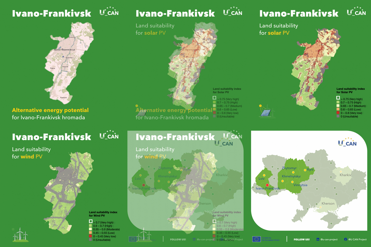
High-resolution spatial mapping provides city leaders and urban planners with a detailed view of renewable energy suitability across Ivano-Frankivsk hromada. By reviewing the animated graphic above or studying the U_CAN interactive map, municipal officials can identify strategic areas for sustainable energy development.
Solar energy potential near Ivano-Frankivsk reaches its highest suitability south and west of the region. Spatial mapping confirms high suitability scores across these sectors, including open areas extending towards Radcha, Cherniiv, and Kaminne, making them key zones for localised solar generation and municipal energy planning.
Wind energy potential is high across large areas of the map, with very high potential concentrated specifically in areas to the south and west of the city. This favourable spatial alignment across both solar and wind resources south and west of the urban centre offers Ivano-Frankivsk strong opportunities for integrated renewable power generation and decentralised energy security.
City officials and planners can use the U_CAN interactive map to explore specific coordinates and spatial zones across Ivano-Frankivsk hromada and other pilot municipalities.