KHMELNYTSKYI HROMADA
RENEWABLE ENERGY SUITABILITY ASSESSMENT
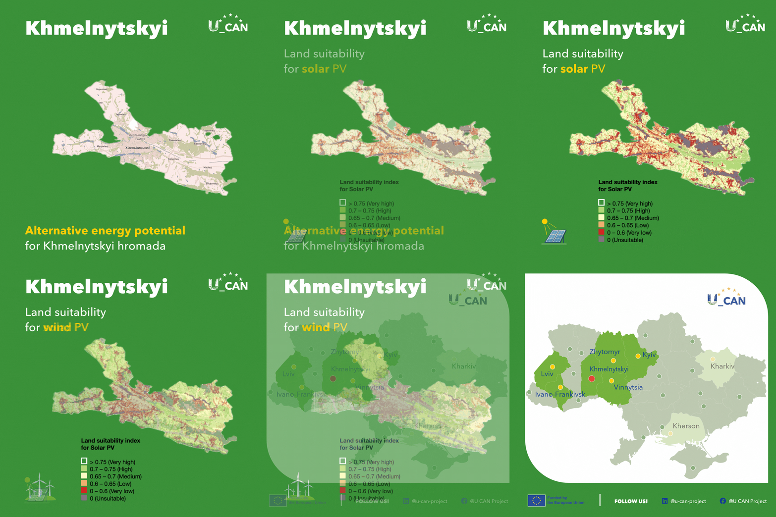
High-resolution spatial mapping provides municipal decision-makers and urban planners with a detailed view of renewable energy suitability across Khmelnytskyi hromada. By reviewing the graphic above or exploring the U_CAN interactive map, city officials can identify strategic priority zones for sustainable energy projects and local power independence.
Solar energy potential near Khmelnytskyi is evenly distributed across the map, displaying moderate suitability scores even near the centre of the city. This widespread potential across both inner urban areas and surrounding settlements, such as Masivtsi, Davydkivtsi, and Kopystyn, offers municipal planners exceptional flexibility to deploy rooftop photovoltaic installations, integrate public building micro-grids, and develop localised ground-mounted solar assets.
Wind energy potential extends across large areas of the map, with very high suitability scores concentrated specifically in the near south as well as in extensive areas to the west of the city. This complementary spatial distribution of both solar and wind resources provides Khmelnytskyi with strong opportunities to build a resilient, multi-source renewable energy network.
City officials, urban planners, and energy managers can utilise the U_CAN interactive map to explore specific spatial zones across Khmelnytskyi hromada and other pilot municipalities.