VINNYTSIA HROMADA
RENEWABLE ENERGY SUITABILITY ASSESSMENT
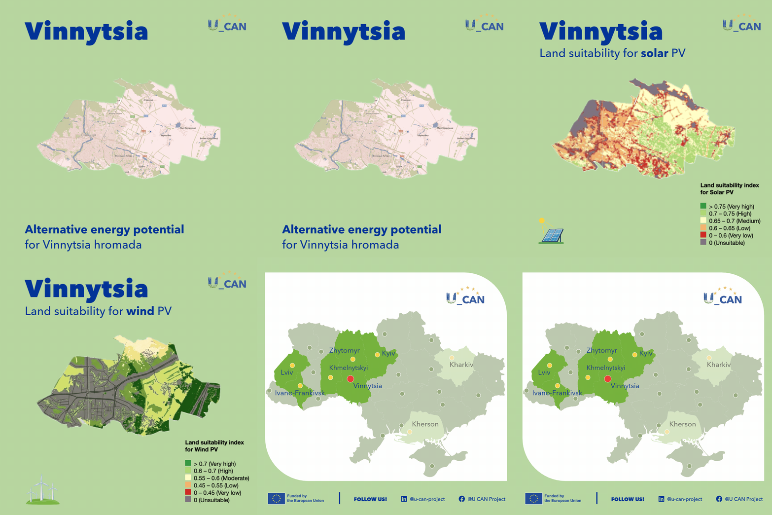
High-resolution spatial mapping provides municipal leaders and urban planners with a clear view of renewable energy suitability across Vinnytsia hromada. By reviewing the graphic above or exploring the U_CAN interactive map, local decision-makers can identify priority areas for clean energy integration and local power resilience.
Solar energy potential near Vinnytsia is distributed across the map, showing higher suitability scores to the east of the city. However, spatial analysis highlights clear constraints: the immediate urban core as well as built-up suburban settlements, such as Vinnytski Khutory, are categorised as less suitable for ground-mounted solar arrays due to high residential density, industrial infrastructure, and spatial limits. Instead, the highest suitability for ground-based solar lies in the open agricultural lands further out to the east and north of hromada, while municipal efforts within settled communities should focus on rooftop photovoltaic systems and localised micro-grids.
Wind energy potential spans large areas of the map, with very high potential concentrated specifically in the near east of the city. This favourable alignment of solar and wind potential presents Vinnytsia with significant opportunities for integrated, multi-source renewable generation.
City officials, urban planners, and energy managers can utilise the U_CAN interactive map to analyse specific spatial zones across Vinnytsia hromada and other pilot municipalities.